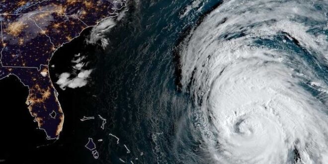
Axios reports:
Hurricane Lee may pass perilously close to Maine and over the Canadian Maritimes this weekend, and it will swipe eastern Massachusetts on Friday night and Saturday, the National Hurricane Center said. Computer model runs, fed with data from hurricane hunter aircraft, depict the storm moving in a generally northward motion, then hooking closer to the U.S. coast as it turns into a Nor’easter type storm this weekend.
Tropical storm watches are in effect for coastal areas of Rhode Island, Massachusetts and parts of Maine, including Block Island, Martha’s Vineyard and Nantucket. This includes the city of Boston. Hurricane watches are up from Stonington, Maine, to the U.S.-Canada border, New Brunswick from the U.S./Canada border to Point Lepreau, including Grand Manan Island, and Nova Scotia from Digby to Medway Harbour.
Read the full article.
Watch Lee transform from a hurricane, to essentially a strong Nor’easter, over the coming days on our simulated satellite. Don’t be fooled by different “status” of the storm! pic.twitter.com/ZRygDbjZHL
— Tyler Jankoski NBC5
(@TylerJankoski) September 14, 2023
[Lee] While today will be a September stunner, our attention has turned to Hurricane Lee, which will brush by the southern New England coastline late Friday night and Saturday. Impacts are expected to be greatest across Cape Cod, where winds may gust as high as 50-60mph. pic.twitter.com/xGTkKK2UlE
— NWS Boston (@NWSBoston) September 14, 2023
Hurricane Lee will put Cape Cod at the highest risk for the most storm surge with up to 4 feet of water rising across the Cape.
The northerly onshore wind will put Provincetown, Brewster, Dennis, Barnstable, Sandwich, and Plymouth at highest risk for storm surge flooding! pic.twitter.com/j8E5mPEvjv
— Peter Hall (@PeteWeatherBeat) September 13, 2023
 Joe.My.God. LGBT News
